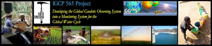
IGCP 565: Supporting water resource management with improved Earth observations ...
|
Read more about IGCP ... IGCP 565: Supporting water resource management with improved Earth observations ... |
| Home | About IGCP 565 | News | Projects | Library | Meetings | Discussions | Workshops |
Workshop 4 (November 21-22, 2011):
Documentation and Output:
AfricaArray:
|
|
|
IGCP 565 Workshop 4: Integration of geodetic observations and products in models of the hydrological cycle
|
|
It is a pleasure for me to welcome you all to this joint session of the 2011 AfricaArray Workshop and the Fourth Annual Workshop of the IGCP 565 Project. First of all, I would like to thank the organizers of the AfricaArray Workshop for giving us the opportunity to co-locate our IGCP Workshop with this event and at this very pleasant venue. There are many synergies between the IGCP project and AfricaArray, and I hope that the co-location of these two evenst will help us to explore these synergies in more depth. It is a pleasure for me to be here at the University of Witwatersrand and I am looking forward to the presentations and discussion we will have during the workshops.
IGCP stand for the International Geoscience Program of UNESCO and IUGS. Formerly the program was called the International Geological Correlation Program, which explains the acronym. Today, this program has a broader scope addressing many societally relevant geoscience issues.
The IGCP 565 Project is titled Developing the Global Geodetic Observing System into a Monitoring System for the Global Water Cycle. This project started in 2008 and will end in 2012. At the start of the project the GRACE satellite showed already many promises in terms of monitoring the global water cycle on regional to global scales. Today, GRACE has exceeded the initial promises and given us a new picture of the water cycle and, in particular, revealed a number of issues with sub-surface water storage changes.
However, GRACE has a low spatial resolution limited to some 250 km or less. Hydrology faces a number of challenges at much smaller scales down to local scales. Regional water management, in particular, is hampered by gaps in the konwledge of subsurface water storage and basin-scale water budgets.
Geodesy has the potential to address some of the hydrological challenges related to water quantity by using surface displacements and gravity changes in an integrated way. This is what hydrogeodesy is about.
The IGCP 565 Projects aims to develop an integrated apporach to hydrogeodesy. A more detailed documentation of the project is available on the project web page. Another source of information about geodesy and the potential of hydrogeodesy is the so-called GGOS 2020 book. A book on hydrogeodesy is in preparation and will hopefully be available by the end of 2012.
A main activity of the project is a series of annual workshops. The present workshop is number four in this sequences. Previous workshops were held in 2008 in San Francisco, USA, 2009 in Graz, Austria, and 2010 in Reno, Nevada, USA. The final workshop will also be taking place in Africa.
I wish us all a successful workshop here at the University and look forward to the presentations and discussions.
In case of problems, mail to info@igcp565.org.