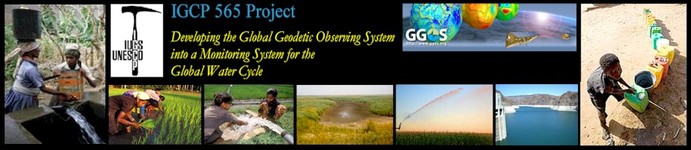
IGCP 565: Supporting water resource management with improved Earth observations ...
|
Read more about IGCP ... IGCP 565: Supporting water resource management with improved Earth observations ... |
| Home | About IGCP 565 | News | Projects | Library | Meetings | Discussions | Workshops |
Workshop 4 (November 21-22, 2011):
Documentation and Output:
AfricaArray:
|
|
|
IGCP 565 Workshop 4: Integration of geodetic observations and products in models of the hydrological cycle
|
|
Monday, November 21, 2011
| 1400 - 1530: | Joint AfricaArray and IGCP 565 Session |
| 1400 - 1415: | Andrew Crouch (Dean, Faculty of Science, University of Witwatersrand): Wits Global Change and Sustainability Institute |
| 1415 - 1420: | Hans-Peter Plag: Introduction to the IGCP 565 Project (welcome note) |
| 1420 - 1450: | Norman Miller: Hydrologic measurements and evaluation data gaps in Africa (abstract; presentation, pptx) |
| 1450 - 1520: | Piotr Wolski: Hydrology of the Okavango Delta (abstract; presentation, ppt) |
| 1520 - 1540: | Chris Hartnady: Hydroseismic lessons from Oklahoma: Cautionary tale for the Karoo (presentation, ppt) |
| 1540 - 1600: | Coffee Break |
| 1600 - 1730: | GRACE tutorial session |
| 1600 - 1630: | Laurent Longuevergne: GRACE: Monitoring River Basins in Africa (abstract; presentation, pdf) |
| 1630 - 1730: | Jürgen Kusche: Analysis tools for GRACE time-variable harmonic coefficients (Lecture Notes; presentation, ppt) |
Tuesday, November 22, 2011
| 0830 - 1000: | Hydrology and Hydrogeodesy |
| 0830 - 0845: | Hans-Peter Plag: IGCP 565: The workshop series and recommendations (abstract; presentation, ppt) |
| 0845 - 0915: | Norman L. Miller, Charles Brush, Jay Famiglietti, Hans-Peter Plag: Groundwater Monitoring and Management for Sustainability: A pilot test in California with possible applications to the Nile Basin (abstract; presentation, ppt) |
| 0915 - 0940: | Hans-Peter Plag: Hydrogeodesy: what is it, how can it help, what are the challenges? (abstract; presentation, ppt) |
| 0940 - 1020: | Jürgen Kusche: Standard and non-standard GRACE products for hydrology (abstract; presentation, ppt) |
| 1020 - 1050: | Coffee Break |
| 1050 - 1230: | Hydrology and Hydrogeodesy (continued) |
| 1050 - 1120: | Laurent Longuevergne: New GRACE hydrology products (abstract; presentation, ppt) |
| 1120 - 1150: | Ben F. Zaitchik, M. Rodell, R. H. Reichle, B. Li, R. Houborg, J. D. Bolten: Water resources analysis and monitoring with the GRACE Data Assimilation System (abstract; presentation. pptx) |
| 1150 - 1210: | Norman L. Miller, Larry L. Dale, Omar Aslam, Meshal Mehta: Assessing Climate Vulnerabilities and Infrastructure of for Small Scale Water Utilities in the Lake Victoria Basin (abstract; presentation, ppt) |
| 1210 - 1230: | Jean-Marie Kileshye Onema: Africa Water Net (presentation, pptx) |
| 1230 - 1330: | Lunch Break |
| 1330 - 1500: | Hydrogeodesy in Africa |
| 1330 - 1350: | Chris Hartnady, Andiswa Mlisa, Eric Calais, Richard Wonnacott, Helen Seyler: Gateway Wellfield Project, Hermanus, South Africa: Implementation, system testing, aquifer monitoring and hydrogeodetic observation (abstract; presentation, ppt) |
| 1350 - 1410: | Elias Lewi Teklemariam: Modern Geodesy and its role in exploration: A case study from groundwater exploration |
| 1410 - 1430: | F.O. Akinluyi, M.O. Olorunfemi and A.A. Omitogun: Integration of Geophysical and Remotely Sensed Data in Regional Groundwater Evaluation in the Basement Complex of Ondo State, Southwestern Nigeria (abstracts; presentation, ppt) |
| 1430 - 1445: | Coffee Break |
| 1445 - 1600: | Water resource management in Africa |
| 1445 - 1500: | Andiswa Mlisa, Chris Hartnady: Space-Geodetic (Earth) Observations in Support of Groundwater Resource Assessment and Drought Management (abstract; presentation, ppt) |
| 1500 - 1515: | Norman Miller: The Nile River Basin proposal (presentation, ppt) |
| 1515 - 1530: | Imraan Saloojee: GEOSS African Water Cycle Coordination Initiative (AfWCCI) (presentation, ppt) |
| 1530 - 1600: | Discussion and Summary: Recommendations for projects addressing river basins. |
The goals of the Fourth Annual Workshop of the IGCP 565 Project were:
The Workshop intended to review the current status of land surface schemes with terrestrial water storage and transfer processes, describe inter-model differences, including weaknesses and strengths. In areas where traditional hydrological observations are sparse, geodetic observations are of high value as observational constraints to such models. The workshop aimed to present approaches to the assimilation of geodetic observations (from local to global scales) into local hydrological models and regional to global land surface models with water storage schemes, and to assess the improvements that can be achieved through such assimilation. Existing challenges were to be addressed and steps towards improved methods and resulting products for regional water management were to be presented. The workshop also aimed to provide an overview of other relevant projects and programs, and in a session jointly organized with AfricaArray, the goal was to explore synergies between the two projects.
The attendees from African countries participated in all sessions, most importantly the overview talks and the GRACE training sessions. Follow-up planning for further training is being implemented, with results to be presented at the fifth IGCP 565 Meeting in October 2012, proposed for Cape Town.
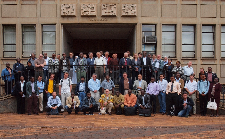
Figure 1: Participants of the AfricaArray 2011 and Fourth IGCP 565 Workshops, November 20-23, 2011, University of Witwatersrand, Johannesburg, South Africa.
The workshop focused on scientific question related to the water cycle at regional to basin-scales in Africa and discussed ways in which hydrogeodesy could support a better understanding of basin-scale water budgets in support of regional water management. Water management in Africa face major challenges due to climate variability and change: among other extremes, one of the largest rainfall deficits on the planet during the last century occurred in Africa. There is a large interannual to decadal variability in rainfall, which is imposed on an already climate-vulnerable environment. The limited water availability impacts all socioeconomic sectors and, among others, causes health issues, urban water shortages, and insufficient hydropower energy production. Such water variability and deficit acts as a threat to African food security, where more than 80% of agriculture is rain fed. In areas such as inland river deltas (e.g., the Okavango delta) other economic activities, including tourism, access to building material, and the sale of products) depend on sufficient rainfall. Consequently, Africa is a “hot-spot” due to the highly sensitive interaction between climate and the socio-economic systems. At the same time, research to understand the effects of climate variability on key reservoirs, such as groundwater, is limited. In many cases, a separating the signals between climate variability and climate changes is not possible due to the lack of long enough observed time series for fundamental variables such as groundwater depth variations. Hence, hydrogeodesy represents a new and fundamental approach for understanding the relationship across climate variations and sub-surface water storage changes. A range of predictive terrestrial water storage models applied to Africa have been under development, but the full integration and validation of geodetic observations into these models is still pending. The IGCP 565 Project provides an important contribution with its focus on developing geodetic products that can be assimilated and integrated into terrestrial water storage models.
The meeting also illustrated the synergies between this project and AfricaArray, where recent developments are increasing the value of the AfricaArray network for hydrogeodetic applications. Other relevant projects and recent meetings include the Middle East North Africa Land Data Assimilation System (MENA), TIGER, the African Monsoon Multidisciplinary Analysis (AMMA), and the GEOSS African Water Cycle Symposium. Research carried out in the IGCP 565 Project, AfricaArray and the other projects mentioned above are of relevance for applied programs related to water management and supply, such as WaterNet and the Famine Early Warning Systems Network (FEWS-NET). Key issues to be addressed are: (1) development of spatial data bases; (2) reliable and continuous monitoring systems that enable a better understanding of the societal problems; (3) capacity building with the goal to have trained users of existing Earth observation systems; (4) development of the infrastructure and the political will to implement science- and observationbased water management.
GRACE is still the key geodetic input to monitoring subsurface hydrologic variations and is the critical link between geodesy and hydrology communities. There are many standard and non-standard GRACE products that support water cycle research that are potentially of value for regional water management. Products such as GPS observations are now available for individual river basins (a total of 218 basins), and these products provide important constraints for the water cycle on basin to sub-basin scales, particularly if combined with other a priori information. Among others, trends in the GRACE-based terrestrial water storage have helped to identify hot spots in groundwater depletion. Assimilation of GRACE data into the Land Data Assimilation Systems has significantly improved the simulation of seasonal and interannual groundwater variations at subbasin scales. With a follow-on mission for GRACE now being planned, we now have a good perspective for the operational use of GRACE products for regional operational water management. However, in many cases, access to the relevant products is not straightforward and requires expert knowledge and training of local users.
One of the recommendations of the Third IGCP 565 Workshop was the development of a demonstration project in California that merges geodetic information with hydrologic modelling via assimilation, leading to technology transfer to African nations through a similar project in the Nile Basin. The pilot project in California is underway and is producing promising results. The workshop participants discussed the options for a similar pilot project in a major river basin in Africa and agreed to cooperate in the development of such a project. We are currently working to advance this plan through a new NSF proposal to develop an African Research Coordinated Network.
Several on-going projects in Africa, which are carried out within the framework of the IGCP 565 Project were reviewed. These projects underline the importance of hydrogeodesy both for the monitoring of both subsurface water storage and the understanding of subsurface hydrologic properties. The projects are (1) the Gateway Wellfield Project, Hermanus, South Africa; (2) Hydrogeodetic groundwater exploration in Ethiopia; (3) Hydrogeodetic studies of water balance trends in the Okavango Delta in Botswana. In the discussions, the workshop addressed a number of emerging projects and followed up the recommendations of the Third IGCP 565 Workshop. In 2009, GEO issued a Call for Proposals with the intent to facilitate funding for proposals passing the review. GEO received more than 70 proposals, with many of them related to Water issues. Teams from Africa submitted seven of the accepted Water-related proposals. Unfortunately, GEO was not successful in facilitating funding. Therefore, four of the proposals were discussed during the workshop in an effort to identify potential ways towards funding. These proposals are (1) Space-Geodetic (Earth) Observations in Support of Groundwater Resource Assessment and Drought Management (in South Africa); (2) Ghana Water Management Proposals; (3) Hydrogeodetic evaluation of regional groundwater resources in Southwestern Nigeria; (4) Application of Global Earth Observation System of Systems (GEOSS) to the management if underground water resources in Nigeria. These discussions are currently being continued.
The workshop brought together more than 40 participants with more than 30 from African countries. Particularly the African participants appreciated the tutorial session on the use of GRACE for hydrology. They also emphasized the need for capacity building related to hydrogeodesy. WaterNet is key to capacity building in water management, and the IGCP 565 project cooperates with WaterNet in this effort. The contributions underlined the main recommendations of the third workshop, i.e., the need to develop a community of facilities for integrated hydrogeodetic modelling, as well as interfaces enabling the use of hydrogeodetic products for water cycle studies and water management. Access to data and tools was identified as a key issue.
The outcomes of the workshop will be documented in a workshop report to be published in Episodes. The workshop followed up and confirmed the relevance of the recommendations reached during the Third IGCP 565 Workshop held in 2010 in Reno, NV, USA:
As a result of the Fourth Workshop, the IGCP 565 project continues to carry out the pilot project in California and to develop a similar pilot in Africa. In cooperation with AfricaArray and other relevant groups, a proposal for an U.S. National Science Foundation Research Coordination Network has been submitted, focusing on the closure of the water cycle budget at the basin scale for major African river basins.
The outcomes of the workshop also underline the importance of a community-based modelling framework for integrated geodetic and hydrogeodetic modelling. As a result of the workshop, an initiative is made to develop this framework and to integrate it with the hydrogedetic data portal and the decision support tool developed in the frame of the pilot project.
The need for improved cooperation and coordination of the various projects and programs addressing watercycle and water-management related studies and activities was highlighted as a critical need by many workshop presentations and discussion contributions will have an impact on the Fifth and final IGCP 565 Project workshop. The fifth workshop will be organized in October 2012 in Cape Town, South Africa, jointly with several related projects as a major African water event bringing together researchers, managers and decision makers in an effort to make progress towards better informed water management in Africa
In case of problems, mail to info@igcp565.org.